
Independent marine surveyors & cargo inspection at U.S. ports
24/7 Survey Inquiries: 404-390-2132 | info@amicamarine.com
Independent ullage, temperature, sampling, OBQ and ROB surveys and ship/shore reconciliation for crude oil and petroleum product tankers at Corpus Christi, Houston, the Sabine-Neches and the Lower Mississippi.
A tanker cargo survey independently measures and samples liquid bulk cargo during loading or discharge. Amica Marine surveyors gauge cargo tanks, record temperatures and free water, witness sampling, calculate quantities at standard conditions and reconcile ship figures with shore tank or meter figures.
Amica Marine provides tanker cargo surveys at U.S. ports for crude oil, refined petroleum products and other liquid bulk cargoes. The Gulf Coast is the center of U.S. refining and crude oil exports, with tankers from coastal product carriers to VLCCs loading and discharging at terminals between Corpus Christi and the Lower Mississippi River.
Every liquid cargo transaction depends on agreed quantity and quality. Terminals measure in shore tanks or by meters; vessels measure in their cargo tanks. Temperature, free water, sediment, clingage and line contents all create differences between the two. An independent tanker surveyor measures both sides of the transfer and explains the difference.
Our surveys cover crude oil, diesel and gasoil, gasoline and blending components, jet fuel, fuel oil and other petroleum products. Chemical cargoes are covered on our chemical cargo surveys page.
The survey report is written for traders, charterers, owners and insurers who need to settle the cargo account, file or defend a claim, or confirm compliance with the voyage instructions.
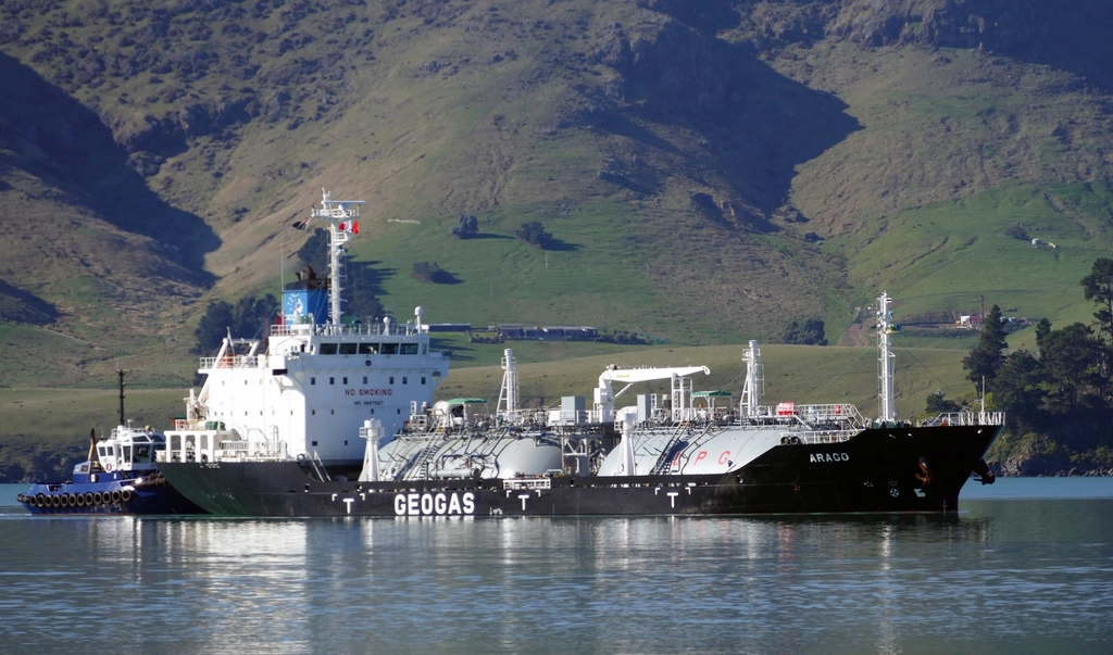
Charterers and cargo owners need a tanker surveyor at loading and discharge, when ship and shore figures disagree beyond tolerance, before loading sensitive grades into previously used tanks, for OBQ and ROB measurement, during lightering, and whenever contamination or cargo loss is suspected.
For high-value cargoes, appointing the surveyor before the vessel arrives allows the OBQ inspection to take place before any cargo is loaded, which is the only point at which it can be measured cleanly.
The surveyor gauges each cargo tank with closed-gauging equipment, records ullage, temperature and water interface, applies trim, list and tank calibration corrections, converts to standard volume using API tables, and separately measures OBQ before loading and ROB after discharge, distinguishing liquid from non-liquid material.
Our tanker survey method follows the API Manual of Petroleum Measurement Standards (MPMS), particularly Chapter 17 on marine measurement, and the related ASTM and Energy Institute standards. A typical attendance includes:
Where closed gauging is not possible, or where sludge or clingage prevents a reliable measurement, the limitation is stated in the report.
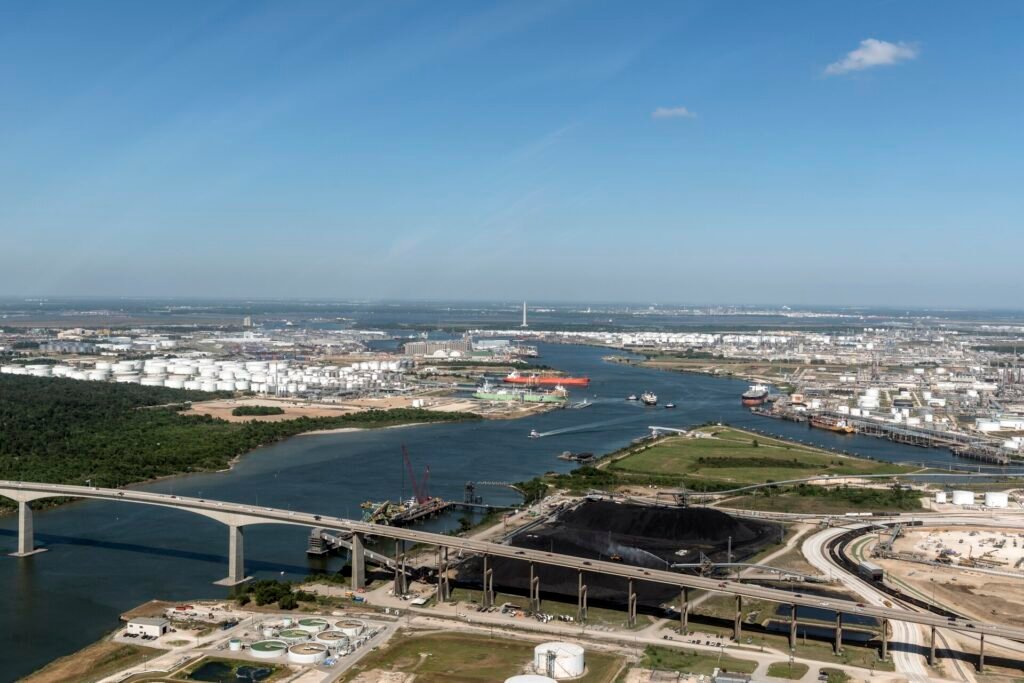
Gulf Coast tanker trades concentrate in a few corridors: crude exports from Corpus Christi, products and petrochemicals along the Houston Ship Channel, refineries on the Sabine-Neches Waterway, and crude and product terminals on the Lower Mississippi. Each corridor has distinct terminals, vessel sizes and measurement issues.
Corpus Christi is the leading U.S. port for crude oil exports, with terminals in the Inner Harbor and at Ingleside handling Aframax and Suezmax tankers and partially loaded VLCCs. Many cargoes are later topped off by reverse lightering offshore. Shore figures here are usually meter-based, so meter tickets and proving reports are reviewed alongside the vessel figures.
The Houston Ship Channel runs about 50 miles from the Gulf to the Port of Houston turning basin through one of the largest refining and petrochemical complexes in the world. Product tankers and chemical tankers often call at several berths on one voyage, which makes careful tracking of each parcel essential.
The Sabine-Neches Waterway serves major refineries and crude and product terminals, including some of the largest refineries in the United States. Crude imports, refined product exports and coastal movements all pass through the waterway.
The river corridor from the Gulf to Baton Rouge includes refineries, crude oil terminals at St. James and product terminals around New Orleans. River current and draft limits affect loading plans and trim, which the surveyor records for each gauging.
The Calcasieu Ship Channel serves refineries and liquid terminals. Product cargoes from Lake Charles often move coastwise or to Latin America.
Large crude carriers are partly loaded or discharged by ship-to-ship transfer in designated lightering areas offshore Texas and Louisiana. Attendance offshore depends on launch, weather and the lightering operator’s arrangements and is confirmed case by case.
Amica Marine offers three tanker survey scopes: a cargo quantity and sampling survey, full tanker cargo supervision from OBQ to ROB with reconciliation, and a cargo loss or contamination investigation. Each scope is quoted in writing after confirming terminal, cargo grade and the documents required.
| Package | Deliverables | Timeline | Starting Investment |
|---|---|---|---|
| Cargo Quantity and Sampling Survey | Opening and closing ullages, temperatures, interfaces, OBQ or ROB, ship figures at standard conditions, witnessed samples, comparison with shore figures, written report. | Attendance at start and completion of loading or discharge; preliminary figures at completion. | Quote on request – based on port, ship location and scope. |
| Full Tanker Cargo Supervision | Tank inspection before loading, OBQ and ROB, line displacement checks, continuous attendance, sampling at manifold and tanks, VEF-adjusted ship/shore reconciliation, time log and protests. | Continuous attendance for the full operation; duration follows the terminal pumping rate. | Quote on request – based on port, ship location and scope. |
| Cargo Loss or Contamination Investigation | Review of ship and shore documents, ullage reports, sample analysis results and line history; attendance to re-gauge or sample where possible; written findings on probable cause. | Attendance while the vessel is in port, plus document review. | Quote on request – based on port, ship location and scope. |
Attendance timing depends on the port and the ship’s location. Prices are not fixed: every survey is quoted on request, and the quotation is confirmed in writing before attendance. Offshore lightering attendance, launch hire and extended waiting time are listed separately.
Book a tanker surveyor by calling 404-390-2132 or emailing info@amicamarine.com with the vessel, IMO number, terminal, ETA, grade and nominated quantity. We confirm scope and quotation, then assign a surveyor on written instruction and coordinate access with the agent and terminal.
The tanker cargo survey report includes tank-by-tank ullage and temperature records, free water, OBQ and ROB statements, standard volume calculations, sample and seal records, ship/shore reconciliation with VEF, a time log of the operation, copies of protests, and photographs of key observations.
Send the vessel name and IMO number, terminal or lightering area, ETA, cargo grade and nominated quantity, the voyage or loading instructions, previous cargoes if known, and the party the report should be addressed to. For investigation work, include the bill of lading, shore figures, ullage reports and any laboratory results already available.
An independent tanker surveyor gives all parties one documented measurement of the cargo, separate from terminal and vessel interests. That record supports bill of lading quantities, settles in-transit loss questions and provides evidence for claims involving shortage, contamination or delay.
Terminals and vessels both have reasons to favor their own figures. Differences of a fraction of a percent on a crude oil cargo can represent a large sum, and claims for in-transit loss often turn on how OBQ, ROB, free water and VEF were handled at each port.
An independent survey creates a consistent record at loading and discharge. It also protects the party that appoints us: owners use it to defend shortage claims, cargo interests use it to support recovery, and insurers use it to assess liability.
Amica Marine records quantities, conditions and events as found. Quality is determined by laboratory analysis of the samples we witness and seal; we report the chain of custody so those results can be relied upon.
These answers cover common questions from charterers, traders, owners and insurers before instructing a tanker cargo survey at a U.S. port. For a specific vessel call, contact Amica Marine 24/7 at 404-390-2132 or info@amicamarine.com.
OBQ is material on board before loading; ROB is material remaining after discharge. Both are measured by the surveyor because they affect the quantity delivered, in-transit loss calculations and any claim between owners, charterers and cargo interests.
The difference is investigated by checking gauges, temperatures, free water, line contents and calculation tables, then applying the vessel experience factor. The surveyor documents the remaining difference and its likely causes so the parties can settle or claim.
Yes. Corpus Christi is within our attendance area. Terminal access requirements, safety training and credentials are confirmed with the agent and terminal before boarding.
Yes, subject to launch, weather and the lightering operator’s arrangements. Offshore attendance is confirmed case by case before you instruct the survey, with logistics costs listed in the quotation.
No. We draw, witness, seal and record samples. Analysis is carried out by an independent laboratory chosen by the parties, and our report documents the chain of custody that supports those results.
Send the vessel name, port, ETA and survey type. We respond to survey inquiries 24/7 and coordinate surveyor attendance at major U.S. seaports on the Gulf, Atlantic and Pacific coasts.